Day 83 – June 25
We were heading for the Kenai (keen eye) Peninsula, which by all reports is the gem of Alaska so there was no doddling and we were on the road by 8:30. The night before while Diane did our late night laundry she was gifted a guidebook by a departing Australian. I had been referred to this guidebook before at our campsite in Whitehorse by a fisherman. Called the ‘Milepost’ it is $35 Canadian and seemed a bit expensive for a yearly publication but after driving a couple of miles with it I am a convert. It describes, sometimes in painful detail, everything along the highways, all referenced to the frequent mileposts. Everything from where the passing lanes start to whether the roadside pull offs are double ended is included along with descriptions of campgrounds and their amenities, stores, historic and geographic information. Here even is a description of where and when to fish and even what to fish with, not that I had any interest in that.
The route out of town was straightforward and we were soon on the Seward Highway heading south east around the Turnagain Arm, a long inland arm of the ocean originally named Turnagain River by Captain James Cook in 1778 when he found that it had no eastern outlet and then renamed Turnagain Arm by Captain George Vancouver in 1794 who apparently was a bit more fastidious about his surveying nomenclature.
However, a rose by any other name, Turnagain Arm provided many photo opportunities of the calm sea with the backdrop of the Kenai Mountain Range behind. There is snow low down on the mountains and many spots where groups of birders and whale watchers were gathered, seeking sightings of their respective mammals. After rounding the eastern end of Turnagain Arm we headed inland where the highway followed the Granite and Canyon Creeks. At one spot further along the highway where the road passed close to Summit Lake and where we stopped to fish and have a coffee and muffin at a nearby lodge I was told by a local that the spring thaw was late this year here and that the snow we were seeing low on the opposing mountains should all be gone by now. My fishing efforts for the roadside were rewarded with one small but extremely acrobatic rainbow trout.
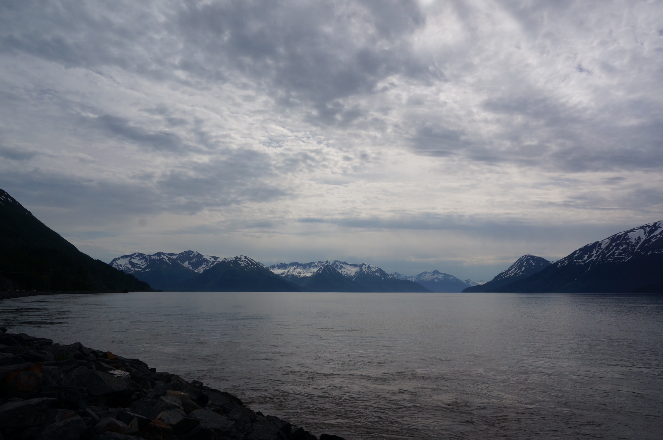
Turnagain Arm
At Tern Lake junction we headed west on the Sterling Highway (they really like to name their roads up here) and soon were driving along the Kenai Lake and Kenai River. Suddenly everything you saw was about fishing, be it guided tours, accommodation, outfitting, crafts and gifts. This was a fish-centric area, I could feel my pulse quickening. The Kenai River is an aqua blue river, a pleasant change from some of the muddy brown and grey rivers we have seen up north and as we found out was now flowing in very high water conditions. I decided to keep my little ass out of that river, it would not have been my preferred way to see the Aleutians. The Kenai is primarily a big salmon river and I also found out that the current run of salmon started unseasonably early and was just about over. Due to all of this fishing frenzy most of the campsites were full and we had to shop around to find a site.
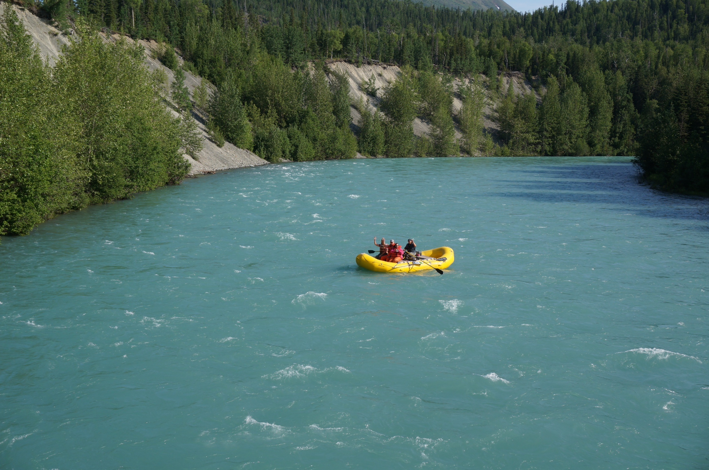
The Kenai River
We eventually found a spot at the Cooper Creek South Park, a dry camping site. Once we had a confirmed site we went exploring for a likely spot to fish. Being in flood there was no bank fishing in the Kenai River so we stopped at a local outfitters shop so I could gather some intel. As I was interested in smaller fish the locals sent me up to the Russian River State Park (which we had unsuccessfully tried to book into earlier) with directions to use day use parking lot and walk into the river where I might have some luck fishing for rainbow trout.
After buying some flies and some apparatus for fishing artificial salmon eggs (I always try to pay for information by purchasing some flies or such in an outfitters store) we headed back towards Russian River. Diane and I walked down to the river which has some of the best public access I have seen. As part of a streamside restoration project much of the bank side is fenced off, limiting access points. The trail along the fence has been built with a plastic grid matting and every couple of hundred yards there is a grated landing with aluminum grate steps right down into the river. Very cool. Long story short, no fish caught, although I did see one salmon being cleaned streamside and there were lots of signs of salmon bones along the stream, probably from the earlier weeks fishing.
We returned to our campsite and had a nice daylight campfire while we ate a ‘clean out the fridge’ supper of fish cakes (Lake Labarge trout) and potato salad before heading to bed.
Day 84 – June 26
We were on the road early, heading to Homer. I had been advised by the staff at the local outfitters shop of a couple of likely rivers to fish on the way. This westerly portion of the road moved us away from the views of the mountains through landscape that could have been Nova Scotia’s French Shore. The first of the rivers on my list, Crooked Creek, was closed to fishing until end of July – so much for local knowledge – my confidence was deteriorating.
As the road reached the western coast of the Kenai Peninsula from Soldotna south the scenery improved again (after miles of spectacular scenery you get spoiled) as vistas of the mountains on the far side of Cook Inlet appeared. With the aid of our new guide book I knew what milepost to stop at for the next river, Deep Creek. A small Nova Scotia- like river it appeared fishable so while I donned appropriate attire Diane positioned herself streamside in a chair with her book. I call this the fishing widow position.
I walked upstream for a while and then fished down, with little action. As I headed back to the BRT for lunch I walked past a deep pool that I had just fished and out of the corner of my eye saw a silver flash. I quickly backtracked and with the aid of my polarized sun glasses I could see several very large fish at the bottom of the pool. Looking at my trout gear it appeared that I had brought a knife to a gun fight but I figured worst that I could do was lose a fly and some leader so, filled with new confidence, I backed up to the head of the pool and started fishing again. Not until I put on a fly that I had bought from the outfitter who suggested this river did I see any reaction and it was a violent one. A sudden swirl as my fly passed over and my rod doubled over.
Flashes of silver in the pool let me know that luckily this was not one of the leviathans that I had seen finning at the bottom of the pool but a fish that I might have some chance in landing with this light tackle. The fish put on quite a show, at one moment diving deep into the pool scattering the other fish and in the next moment leaping clear of the stream. The sound of line peeling off my reel alerted Diane that lunch was going to be late. After a couple of minutes I brought the fish to my side and was able to briefly hold it before releasing it back to the stream, a small Pink Salmon. Catching and releasing the salmon whet my appetite for another hour of fishing which was not as productive. I left the stream knowing that we had to retrace our steps back this way in two days and that I would be better prepared next time we stopped here – hope springs eternal in a fisherman’s heart.
With some minor interference from road construction we soon made it to Homer, which was under clouds and a light rain. We drove right out to the end of Homer Split. At 4.3 miles long the Homer Split is the second longest spit in the world. The narrow tract of land is lined on both side with shops, fishing charter companies, rv parks and commercial fishing operations and their supporting trades.
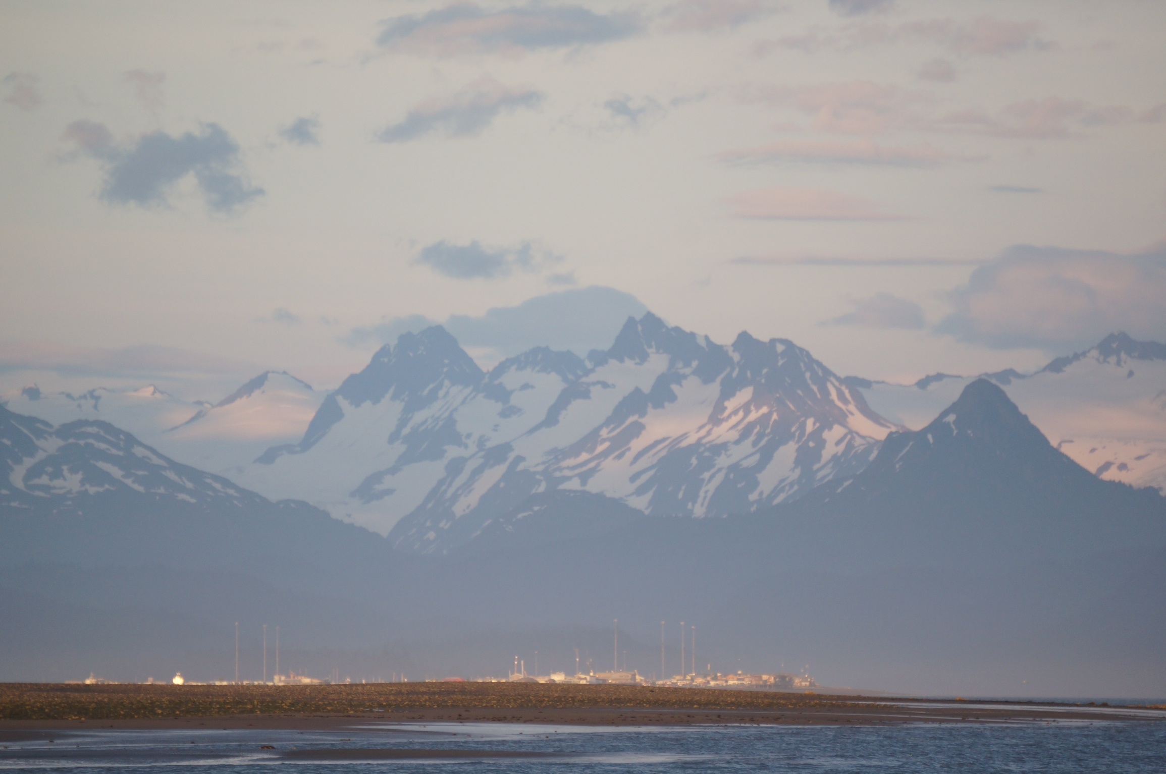
Thanks to our guide we knew where the rv parks were and as scenic as the spit may have been the parks there were just gravelled sites with little privacy so we headed back into town looking for the information centre which we somehow had driven past on the way in. After a quick look around there we decided to try one last park slightly further out of town. The Ocean View park, offering full service and wifi had terraced grasses sites down to the ocean and we found a site that provided a great view across Cook Inlet to the mountains that were now appearing through the clearing skies.
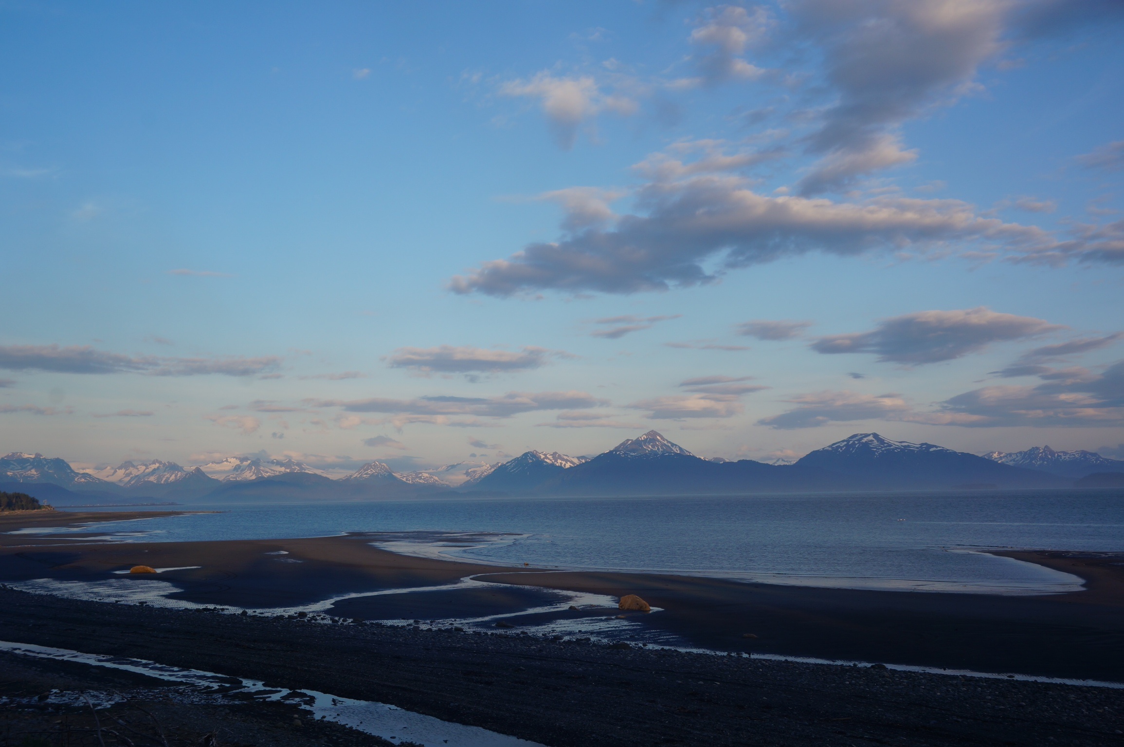
The view from Ocean View
We set up camp, read and sent some e-mails, and relaxed. I made potato omelettes for supper after which we took advantage of the falling tide to walk along the shore. At one point we heard a buzzing noise overhead and looked up to see a flying craft of some nature. It took a moment to get its scale, with its flashing red and green lights but we soon realized this was a model quad copter but no operator was in sight. It flew over our heads and far down the beach, well beyond the range of any such toy helicopters I was familiar. We stopped to talk to a mother and her daughter along the beach who were also watching the show only to find out that it was their husband/father who was standing beyond the ridge of the beach who was piloting it.
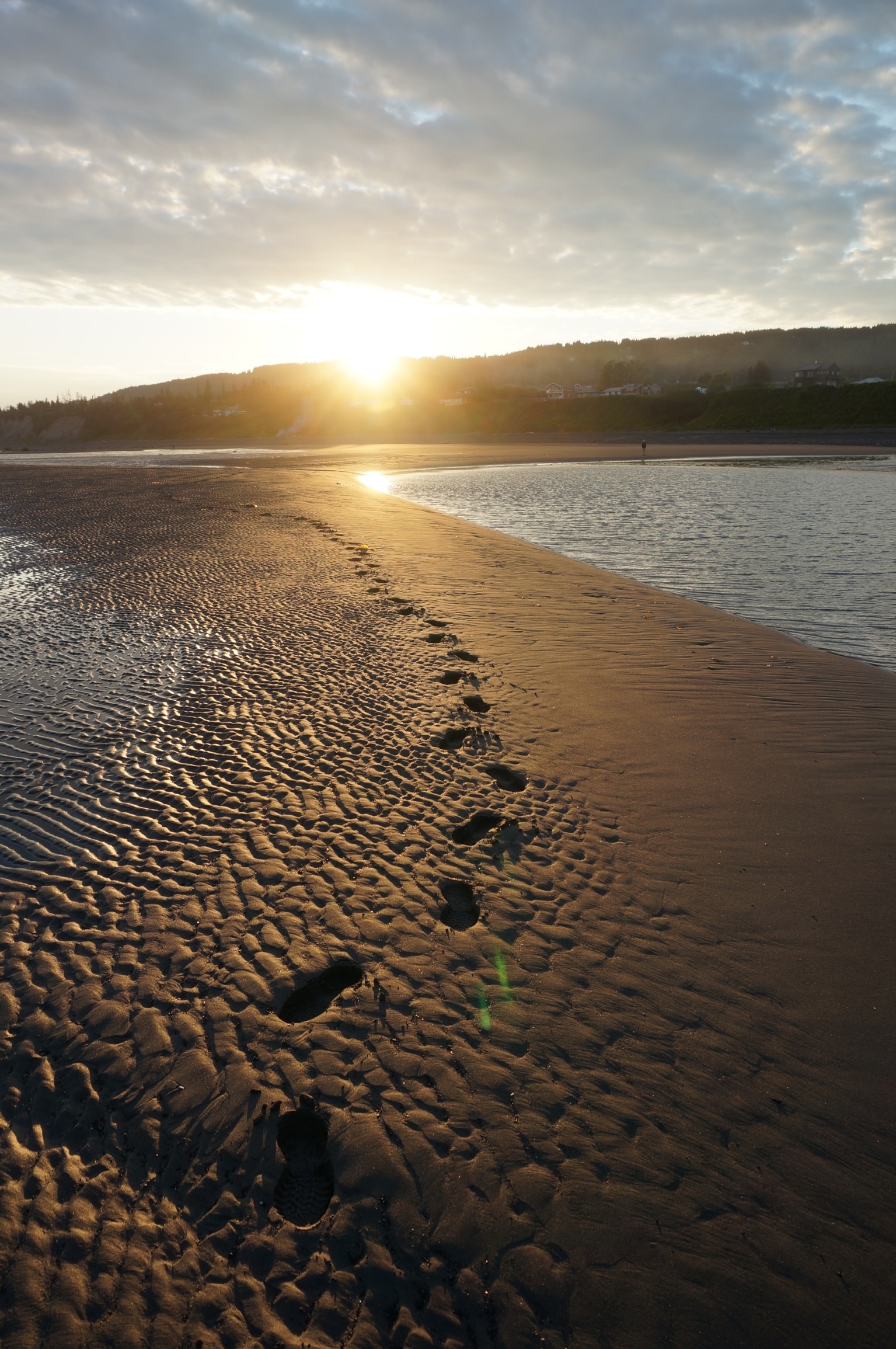
Homer beach
Homer Spit
We joined them as they walked back to the landing site where we saw the pilot with his controller in hand and wearing video glasses bring his copter to ground. As you might expect he was only too eager to show us his equipment which included a GPS controlled quad copter complete with video camera and special glasses he wore that let him see what the copter borne camera was seeing. The family were former Homer residents and gave us some great advice on local sights before we returned to the BRT at 11:30 under the still light skies.
what spectacular vistas!