Monthly Archives: April 2013

April 29, 2013 (Westward ho!)

These time changes have really been great, as we gained another hour yesterday, which allowed us a relaxing start to the morning. Today was a travel day, and the scenery could not be beat, with wide open skies, and massive table-top “mesas” as far as the eye could see. As we drove through Albuquerque, we could not get over how clean the city was, with its terracotta-painted overpasses and boulevards of cactus rock gardens. Sean figured he could live here for awhile.

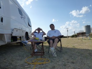
Today was also to be our inaugural visit to “Campers World”, just past the city where their big sign beckoned. An hour and a half later, and $200 poorer, out we came with both the “need to haves” (water filter, levelers, etc) and the “want to haves” (Sean got a fancy new camping chair which is super comfee and folds into nothing).

Again we jumped on and off Route 66, but not as often, as there was much less of the original road here. For example, the state saved the route 66 bridge that crossed over the Rio Grand, but there was no road on either side of it, so it just sat there, parallel to the I-40, for all to see as you whizzed by. We also drove through a few more “66” towns like Gallop, which has thriving vintage motels, gas stops, and businesses, and is also a trading center for both the Navajo and Zuni people of the area.

By the time we crossed the boarder into Arizona it was 5pm…. on no, wait a minute… another hour saved… its only 4pm, but we are both wiped, and decided the $42 Days Inn price cannot be beat, so another 30 mins and we arrived for the evening. Another great day!

April 28, 2013 (Hiking the Lighthouse Trail…. in Texas no less!)

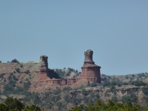
Got up in our 0.5 Star campground (parking lot) with chilly morning air but a decent breakfast. Left and headed down into the Palo Dura canyon and hiked the Lighthouse Trail for about 3 hours. Very hot in the canyon floor at 27C when we started and 32C when we finished. It is called the Lighthouse Trail as the end point of the effort is a hoodoo shaped like a lighthouse (it also looks like other things but not quite sure what, I will have to ask Phil and Ike).

The Lighthouse Hoodoo

The Lighthouse Hoodoo

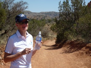
Who says this girls can't trek

Who says this girls can’t trek

Texas Bear

Texas Bear

The canyon was wonderful and what a park it would be to cycle in. The entire 120 mile canon floor is accessible for bikes, horseback riding, and hikers too.

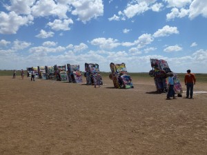
A quick shower and a quick plug-in for AC at the campground allowed us to nuke our leftover curry for lunch. We then blasted off to the west of Amarillo to see the Cadillac Ranch… it is a performance art piece from years ago that features 10 Cadillacs buried nose-down in a field. There are left over spray acns of paint on the ground and the owner encourages folks to help themselves and paint them any which way you want. A little weird so it appealed to us.

Cadillac Ranch

Cadillac Ranch

Then off to the tiny town of Adrian and the Route 66 “Midpoint Cafe” which is 1,139 miles in each direction to Chicago and LA. The place is known for pies and wow, I had a massive slice of chocolate cream pie. Yummm! Sean had a great conversation with Denis, the owner, who regaled him with stories about the cafe and history of the area.

The day was now quite hot and the AC went on again. Although Texas is mostly known for oil they are apparently on the run for energy conservancy too which is nice to see. We saw wind farms with 200-400 windmills each. The other feature were dust devils, mini-whirlwind tornado things that reach from the surface to about 400m or so up. It probably extends further up but the debris doesn’t make it that far so it is sort of invisible. Too cool. One about every 4 square miles in a casual survey.

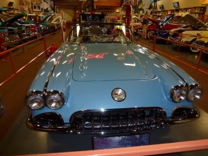
Drove along more of Route 66, visiting the ghost town of Glenrio which was quite spooky, and then crossed the boarder into New Mexico and the welcome center. This followed with a final stop at Russell’s Truck stop, to see the owners antique car collection, that was not to be missed. He has set up a museum at the back of the truck stop and it is really something…1927 Model T Roadster, 1929 Model A Pickup Truck and a mint condition 1959 Corvette Convertible, were just 3 of the 26 vehicles he had on display. He was also a Marilyn Munroe fan and had tons on memorabilia on the wall around the room. The museum was free and all donations went to the local food bank. Isn’t that great!!!!

1959 Corvette

The recommended state park was not described in glowing terms so we opted for a commercial site in the town of Santa Rosa. An old KOA it was dusty and lifeless with just a few trees. But the amenities were perfect. And at 5000 ft above sea level it chilled rapidly with sunset. We met Lynn and Darwin, from Reno and their 3 terriers, and struck up a conversation that ended in Sean trying to help Lynn with her WiFi. Their motor home was one of those massive buses with a 70 inch plasma TV. You could square dance in the kitchen. After laundry, salad and movie, we packed it in for the night.

April 27, 2013 (Gettin’ our kicks…)

Climbed out of Red Rock Canyon State Park a little later than planned, at 10AM, but well within our meetup schedule with the others so pressure was off. We also knew that we were getting ever closer to merging our routes as we headed west and the others climbed north and north-west. (by the way Carmel, I think in answer to your questions, ‘What happens when all the MRTs meet?’, sh-t happens I think!

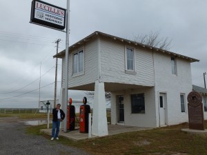
We continued tracking the Mother Road with stops at Lucille’s Gas Station (Lucille was considered the mother of the Mother Road and ran this station for over 50 years). The design (see below) is called ‘live over’ style where the accommodations are on the second floor and bedrooms reach over top of the area where cars are fueled underneath, a drive through if you like. Not sure I would want the kid’s bedroom over top of fueling cars but whatever. Nice to see it so well preserved.

27Lucilles

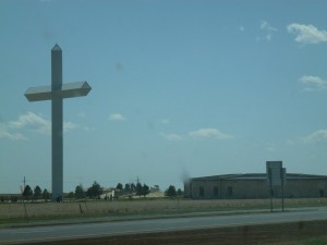
We then headed along various sections of Route 66 and popped into a few small towns such as Weatherford, Clinton and Fosse where main street was very wide, perhaps 4-6 lanes, and about 1/2 mile long then nothing. Every small town listed their churches on large welcoming boards and there appeared to be more churches than people. Crosses were prominent. Below is a big Jesus cross, seriously, it’s big!

Big Jesus Cross

Then on to Elk City (was named Busch for a while in fond hopes a brewery would re-locate there – never happened so back to Elk City as a name) to see the Route 66 National Museum. Also included was the Transportation Museum and the Olde Town Museum complex. This included an old Opera House and chapel that are used for many functions even today, and indeed on this day, a wedding. All very nice. Cute flower girls running around in the heat and the boy equivalent (sorry ladies) pretending they didn’t want to be there. The museum even included a rodeo section as the town was obviously famous for this pursuit. Carved saddles and luggage for travelling along was all made of very nice heavy leather (from the losing horses perhaps) and a little over the top in terms of adornments, carvings, silver, gold, etc ( We will leave it to your imaginations). We then headed for a lunch of burgers and milk shakes at Braumes, obviously a popular place with grandparents and grand kids on a Saturday morning after little league as kids a plenty in dirty uniforms and proud grand parents with cowboy hats and big buckles… although that was mostly the men (KD lang no where to be found… thinking of Phil here).

Having seen absolutely everything in Oklahoma (kidding) we blasted down the highway for the Texas border. The challenge was making the Welcome Center (can’t say enough good about these places, they are great) which are usually placed just inside a state close to the entry points. But Texas, decided that the panhandle welcome center should be placed where it serviced the southbound, eastbound and westbound (us) customers from one point. Smart but it did force us drive almost 100 miles in from the border and to pick up the pace as we wanted to book a neat canyon site in a National Park and it was Friday after all. What really helped is that Texas thinks 70mph is for Nancy Boys and so upped the ante to 75mph (obviously a state that produces even more oil that Oklahoma).

As Phil mentioned elsewhere, Texas is dry. Oklahoma just came off a two year drought just the previous week and is quite dry but driving in to Texas is something else. Nothing green unless it is watered and there is plenty of that going on. And flat, how flat is it ??? it is so flat you can see the New Mexico highway signs in the distance. And hot, we hit 30C and by time we got to the welcome center it seemed hotter. The place is half-buried in the ground and the dry moat surrounding it says not to let your kids play in there due to rattlers, yikes! Since we didn’t get there til after 4pm we were out of luck in staying at the Palo Duro Canyon State Park, given it was also Friday night and this was the park of choice for most campers. From all that we had read, we really wanted to hike the park the next day, so it was recommended, as an alternative, that we stay at “Big Tex RV and Resort” that was just next door.

Campsite envy

Campsite envy

When we arrived, the owner came over and introduced himself. Carla had spoken with him from the welcome center about getting a treed space at his campground. When he realized who she was he proudly pointed out the two trees (one was dead) available in his campground. The rest could be summed as the good and bad scenario – Good: you could spit and hit the state park next door in the canyon. Bad: they weren’t really open yet, but couldn’t pass up the overflow from the park and charged us $25/night for dirt, leaky water fawcet, crappy bathrooms, and no other amenities. They recommended that if we wanted a shower, we should pay $5/ea to go into the park and use theirs!! It was a bit depressing, but it did have a nice view as it was located on the rim of the canyon and we walked over to take pictures at sunset.

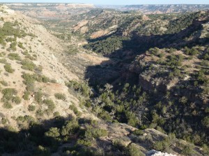
The Palo Dura Canyon

The Palo Dura Canyon

To celebrate our first night in Texas, a state known for its hot food, we made curry and settled in for the night. A quick Facetime to Casey in Nepal, enabled us to catch-up on her news, and begin planning our rendezvous with her in BC in June.

Passin’ on El Paso

Day 23 – April 26

Wheels rollin’ by 8:00 was our target and we hit it this morning. Our plan was to have breakfast at the restaurant where we watched sunset last night. We saw that they had a wi-fi connection and not having had one, or a shower for that matter, for several days we were all behind in our communications back home. Wi-fi connections have become sort of a holy grail for us. Typically our collective company is chatty and gregarious but put us into a wi-fi spot and everyone is heads down and fingers flying – we are a long way from the old days of backpacking when you would leave a message at the next American Express office.

Jane took the opportunity to Face Time her firstborn, Graham, who is working in northern B.C. In fairness to Graham, being awoken by someone who is 2 time zones ahead of you is a rough start to the day but he rose to the challenge and managed what by some standards could be called a conversation, even using some multi syllabic words. Good job Graham !

Blogs were posted, e-mails answered and bills paid. Life goes on – even on the road. I wonder how Jack Kerouac managed.

I took the opportunity to go into the park store and buy a couple of lengths of rope. In the high winds of the previous day in the mountain basin I thought it prudent to tie down the canopy to avoid the BRT being flipped on its side. Embarrassingly I realized that amongst the vast store of provisions that I had loaded into the belly of the BRT I had not included rope. Fortunately Ike had the forethought to have packed some rope that was just long enough to secure the canopy to the boulders at the edge of our site. If they moved we had much bigger issues.

As we made our way back down from the mountains we were struck by how rapidly the landscape and vegetation changed. Soon we were back in the expanses of lower hills and plains. Even at 10:00 in the morning the heat is building to a predicted high of 100 degrees. A good day for the air conditioned splendour of the ‘RT’s. We headed west on the 170 headed for Presidio where we planned to turn north towards El Paso.

The 170 follows the path of the Rio Grande and initially the road was close to the elevation of the river witnessed by the frequent flood markers along the roadside. However it soon climbed into the mountains providing vistas down a canyon side to the pea green Rio Grande as it winds it way east to the Gulf of Mexico. Progress was slow as frequent stops were required for photographs and cooling of the brakes. I’m feeling very appreciative of the new brakes that were installed when we bought the BRT.
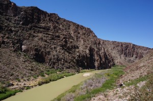
The pea green Rio Grande

The pea green Rio Grande

Not only did the road twist left and right following the turns of the Rio Grande it also, at times, approached roller coaster proportions complete with that ‘what happened to the bottom of my stomach’ feeling as we crested some of the rises.

At Presidio we headed north on the 67 to Marfa where we had a late lunch and then after a quick provision stop headed on the 90 to Van Horn. After a brief conference we decided that we would try to get close to El Paso and start looking for an RV park or campground. El Paso is a sprawling twin city with Ciuad Juarez in Mexico with the # 10 Interstate running through it so we kept on driving and just after the New Mexico border found a small RV park , the Western Skies RV Park, that was acceptable i.e. had showers, water and power. We had a good supper of mini pizzas built on tortilla bread. It was a windless night and despite our proximity to the #10 Interstate we ate outside under a star filled night that once again was punctuated by the rising of a brilliant waning gibbous moon (Jen, Colin, hope I got that right).

Day 24 – April 27

OK in hindsight ‘acceptable’ may have been an exaggeration. Issues in order of increasing importance, Family #1’s site had a broken electrical outlet so power was provided via a long extension cord from Family # 2’s site. Only upside to that was it helped me rationalize why I’m lugging a 50 foot extension cord around.

The taps in the washrooms were devoid of even warm water, the plywood doors on the toilet stalls didn’t lock but the toilets did flush. As for the much anticipated showers, in the men’s side, one of the three was out of order, considering the condition of the two ‘operating’ showers I can’t imagine what apocalyptic event transpired behind door #1 to have it categorized as out of order, possibly some rift in the time space continuum. The shower heads in the operating showers looked like the before pictures in a CLR ad. The stalagmites of calcium deposits on them were reminiscent of Sean and Carla’s description of the caves in Luray. I chose the one with the fastest dribble only to find the additional bonus that the drain didn’t work so shower time was limited by the height of the shower sill – not an issue really in light of the rate of water flow.

One the positive side each site had a sewer hook up so I was able to do a grey water dump, getting pretty good at that now – another step closer to my RVer’s badge. I am still working on the RV wave however. This is the wave fellow RVer’s give each other when they pass on the road. Although seemingly simple to the untrained eye, the seasoned RVer executes the wave with an economy, ease and grace reminiscent of a Gordie Howe high elbow back in pre expansion days. The wave is given with either the left or right hand that is strategically resting on top of the steering wheel. You must not remove the wrist from the steering wheel during the wave. Lifting the wrist from the wheel is considered bad form and overly exuberant. Any use of the elbow during the wave is a clear indication of a newbie.

We checked out and were pleased that the posted rate of $38 per night (a galling amount in light of the quality of the amenities) was in fact only $26 including a 10% discount for being Good Sam members. A small salve on the wound that is now referred to as the ‘Western Skies Incident’.

We headed out at about 8:30 on the # 10 headed for Silver City and the Gila (pronounced heela) Cliff Dwellings in the Gila National Forest Park. We were well positioned for our May 1 rendezvous at the Grand Canyon so we anticipated a more leisurely driving day than the previous one.

We decided that the most direct route to the cliffs was along route 15. On paper you couldn’t argue with that, however what we didn’t know was that route 15 was basically the back door road to the cliffs. It took almost 2 hours to traverse the posted 43 miles to our destination. That was because route 15 was one continuous switchback.
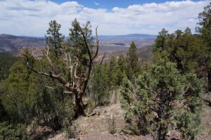
View from the 15

View from the 15

At one point the switch back was so tight that I actually could see in the back window of the BRT from the passengers seat. Diane and Jane were in their respective drivers seats and did yeoman service as we climbed and dropped our way up and down the unguardrailed road to the cliff dwelling site.

Luckily there was little on coming, or following traffic. In retrospect a clear sign that, like Robert Frost, we had chosen the road less travelled. In most places the road did not even have a centre line marked. We finally intersected route 35 which by comparison was a super highway and ended up at the information centre for the site where we took the opportunity to eat lunch and fill up our water bottles for the hike to the dwellings. We were told that it was about a one mile round trip and after a briefing from park staff about the protocols of staying on the trail and not touching the artifacts we left on our hike.

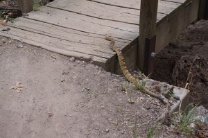
The path was a pleasant, well marked trail through a pine forest. Ike was leading the way and as we approached a small footbridge we all were stopped by a strange sound. As Ike examined the tree tops for some unfamiliar bird Jane spotted the source and directed Ike with an urgency saved for very special occasions to (and this is a translation) move along. What we had spotted on the edge of the trail, not 3 feet from Ike as he peered obliviously into the tree tops, was a coiled and annoyed rattlesnake.
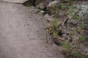
Ike's surprise

Ike’s surprise

Following Ike

Following Ike

Now all the information brochures and interpretation panels in the world can’t prepare you for coming face to face, or face to ankle as was the case here, with one of the most notorious snakes in the world. Although we had had a great discussion on the Natchez Trail with a volunteer who travelled with a reptile show and had been advised that there hadn’t been a death due to rattlesnake bite for decades, none of that information seemed pertinent in comparison to the human primal fear of snakes, especially a coiled, rattling one.

In moving past the snake Ike executed manoeuvres that would have been the envy of both Mikhael Berezenkov and Donovan Bailey as he took a position further along the trail that was not only well beyond snake strike distance but possibly beyond Scud missile range. It took several minutes before the snake moved off the path and crawled under a rock and the rest of our intrepid group felt it was safe to pass. Now as the photographs will attest this was not a huge snake, possibly 2 feet long, but I am confident that in the retelling Ike will eventually have it several orders of magnitude longer and the description of his encounter with this reptilian monster will dwarf the tales of the epic battles of our time in comparison.
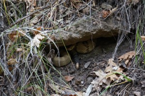
Waiting for the next hiker

Waiting for the next hiker

Thirty seconds later we noted a sign along the trail with a picture of a snake on it that read ‘Please Stay on Trail’. Who knew that New Mexico snakes could read. The rest of the trip to the dwellings was spent paying very careful attention to the path, rather than to the surrounding scenery. Ike in particular seemed to have developed a heightened sense of awareness to all his surroundings and subtly had allowed Jane to take over lead position.
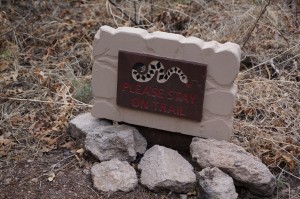
Watch for the signs

Watch for the signs

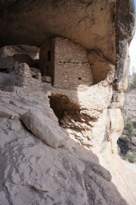
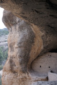
Arriving at the cliff dwellings was once again one of those experiences that the pictures can’t prepare you for. Originally occupied on a transient basis by nomadic tribes the caves were eventually used as a permanent dwellings by the Mogollon Indians around 1200 A.D., almost 300 years before good old Chris Columbus discovered ‘merica. Could you imagine their anxiety for all of those years anticipating their impending discovery. No wonder they focused on things like making decorative pots and growing crops in anticipation of the first craft fair where they could trade their goods for more useful things like measles and beads.

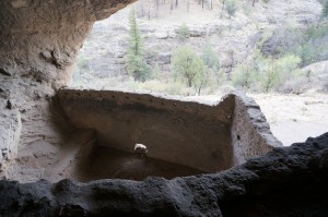
The caves were carved out of the soft rock eons ago by the eroding waters of some long disappeared river, leaving deep recesses whose overhangs provide shade from the sun in the heat of summer but yet allowed the warming rays of the low winter sun to penetrate. There are 6 caves that were accessible and occupied with a 7th that was inaccessible. The Mogollons built low walls out of small rocks and mortar to divide the space into family areas, having a communal kitchen in one of the caves, possibly in an attempt to keep the attraction of food to the wildlife away from the sleeping and living quarters.
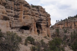
The Dwellings

The Dwellings

By way of a set of steps you are allowed to access some of the caves and truly be able to experience the intimacy of the dwellings. Many of the nooks and crannies within the caves have been adapted with small walls and shelves to provide storage for the everyday necessities of their lives. In a strange moment of connection it occurred to me that although so different in so many ways, our current life in the BRT has some similarities in the economies of space and the need for orderliness.
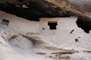
image

A room with a view

A room with a view

image

image

image

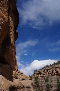
We finished our tour at about 4:00 and although the drive in had been entertaining we decided to use route 35, the front door, on our way out. About 30 minutes later we saw a state park campsite and decided that rather than driving further we would stop for the night. A great meal of barbecued pork chops, tabbouleh salad and Greek salad prepared by Jane and Ike was once again eaten under a star filled sky. The later rising moon is now affording us an opportunity to really appreciate the huge light pollution free skies of this area of New Mexico.
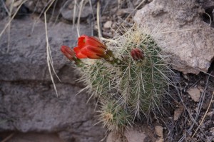
Scenery along the way
Scenery along the way

April 26, 2013 (battening down the hatches in Red Rock Canyon)

Well, the day started off dull and grey then blackened considerably as a major CB cloud rolled through. Thunder was almost simultaneous to the lightening attesting to its proximity. We were still in the bunk at this point and didn’t give a tiny rat’s a–. It passed through quickly and the day continued warmish with 18C and overcast. Perfect weather for exploring the Oklahoma sections of the “Old Mother Road” or Route 66.

Every small town along the route had some story and something unique to offer. The actual route is mostly gone but there are whole sections next to the secondary road that you can drive on for a few hundred meters before you need to retreat because a bridge that once existed is now gone. But the newer road does go through the same little towns and hopeful villages as before. Old stores shuttered and whole towns that are mere memories of the past glory days. Some areas appear to be trying to capitalize on the mystique of the old route that ran from Chicago to Santa Monica and saw it’s heyday end in the 60’s but these efforts are obviously a struggle. But there continues to be much interest. We stopped at a unique winery called Stable Ridge (it is Oklahoma after all) and tried various offerings that were just fine. We were told that 68 Australians had come through earlier in the day in 32 cars and they were intent on following every little bit of Route 66 that remained. This is not an uncommon pursuit apparently. Later in the morning we went through a small village and low and behold it was crowded, yes, the Aussie flotilla has invaded the near ghost town with big southern cross flags and much fanfare… We escaped further to the west for lunch in the little village of Border Town. This was the easternmost point of the the great land grant where everyone got a chance at free land to start a new life. Tom Cruise and Nicole Kidman were featured in a movie called Far and Away that covered this period. From the notes for this event, it appeared the day started with green prairie everywhere and by nightfall there were major tent cities everywhere… what an idea… Anyhow, Okie (also Sooners) don’t stand on much on fancy so lunch was pulled pork (excellent) and a 1/4 pound hot dog on big bun with chilli and cheese a plenty. 5000 calories and OMG! Drinks were root beer (big paper cups that the waitress kept filling). I asked for coffee and was offered Nescafe so opted for tea. When I asked for milk it came in powdered form and of course, all was in paper cups.

We then stopped at a round barn from 1890 or so that had been rebuilt about 20 years ago, They used to hold dances in the upper area during the depression era. And then on to Pops. They have 150 brands of soda which I suspected were all just flavours to be added to a base of soda water but in actuality they have assembled the best 150 sodas (pop) from around the world. Sounds weird but I picked up a ginger beer from Jamaica and another from the states and Carla found a blood orange from Bundaberg in the Queensland area of Aus. I have had their rum before and it is not too bad at all. Very neat if not so authentic to the Route 66 theme.

We had pre-called Verizon from the day before at the welcome center upon entering Oklahoma. I laid out the sad, sad story and the manager Jonathan promised to sort through so this afternoon was a quick visit to a corporate store and suffice to say that the MRT is now one high-speed, fully wired turd with access even from within our present location, the Red Rock canyon, yea.

We arrived here in Red Rock before 17:00LT (a first for us) and settled in to a nice spot with power and water and some great neighbors. This state park is in a canyon with about 20-30m high walls. But the canyon is just 1/4 mile wide where we are and a river shares the bottom. Apparently nearby you can still see the tracks from the wagons that were west bound a couple of millenia ago. Sort of cool. These canyon walls are also popular for rappelling from for those that are into that sort of thing.

As for good neighbors, when I put out the awning (spelled Aaaaawwwwnnnniiiiinnnnnngggggg here in Oklahoma) our neighbors suggested this might not be best due to unsettled weather left over from this morning. I looked about at the fluffy white clouds, warm air, setting sun and acknowledged their concerns as this part of the world is known for changing weather in the form of tornadoes etc (I always laugh at the oft heard comment that if you don’t like maritime weather, wait 30 minutes and it will change. Except for fog rolling in Novi weather is pretty darn stable by comparison to most places we have been on the planet…) Anyhow, we started a nice fire, set the table outside, had some drinks going and I pointed out the darkening sky to Carla. Within 10 minutes we had retreated to the MRT interior with all outside packed away. Hail hit first, then torrential rains and winds and near-continuous lightening. Clever neighbors aren’t they!

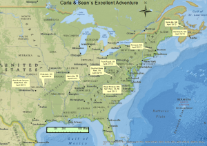
Following is a rough map of our route so far. we have traveled a lot of distance so far but also experienced a lot. We fully appreciate that you could spend a lifetime along this route we have chosen and probably still not see it all. But the world is large and there is much to see so onward we go…

More Route 66 tomorrow and into Texas along the Mother Road.

RVUSATour

We’re Round The Bend

Day 21 – April 24

In anticipation of an early departure and a full day of driving my Ipad alarm song of All Day and All of the Night awoke us at 6:30 to much cooler weather than we have been used to over the last week, temperatures in the 50’s rather than the 70-80’s. We were hoping to get to, or close to, Big Bend National Park in Texas so were prepared for a long haul, 2 driver day. Big Bend is situated on the Rio Grande River, which forms the border between Texas and Mexico.

We drove for miles and miles along the 377 south through very arid countryside. In places it is so rocky that there isn’t even a sign of grass. There are however masses of a scrub tree that seem to be a short lived species as most of them had either some withered grey branches or had given up the ghost altogether and stood leafless. We have been told that Texas has been in drought for about 3 years so this may not be the typical landscape.

Dry,Dry, Dry

Dry,Dry, Dry

There are very few signs of livestock. In an hours drive we only saw a few longhorn cattle, some very large goats and one horse. However lots of turkey vultures soaring in the sky and feeding on the frequent road kill of the small deer which populate the area. We have seen several wild turkey and a roadrunner, which was very cool. However no Acme shipping crates or Wilie Coyotes have been spotted so far.

As we got closer to the Mexican border we saw an increased presence of US Border Guards and at one location we were stopped while two guards and a German shepherd inspected the vehicle. Apparently we didn’t have any of what they were looking for so the stop was short.

The landscape and vegetation changed slowly as we made our way west and south. The roadside colours of the day before were replaced with a subtle palette of browns, greys and greens that had their own beauty. We began to see more rock out crops along the road and in places where the road had been cut through the hills various colours of geologic formations were laid out in distinct contrast.

I wasn't driving at the time

I wasn’t driving at the time

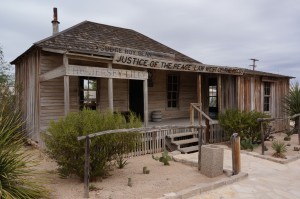
We stopped for lunch at Langtry, the home of the famous western judge, Roy Bean – ‘the only justice West of the Pecos’. His admiration for the British songstress Lilly Langtry led him to the name the town after her. The visitors centre for Langtry is built on the grounds of Judge Bean’s old store/courtroom, which is still in tact and provides an interesting glimpse into the history of this Western culture. The visitors centre also boasts a lovely cactus garden, many of which were in bloom, despite the drought conditions.

Langtry - home of Judge Roy Bean

Langtry – home of Judge Roy Bean


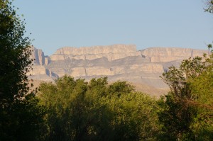
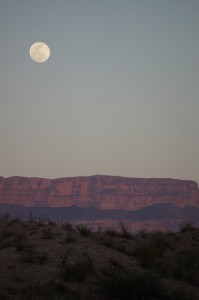
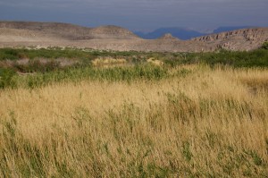
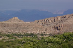
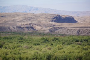
As we headed due south from Marathon to the Big Bend National Park the landscape and scenery went into overdrive. Beginning with some small hills and culminating in spectacular cliffs of every shade of brown, the road ended at Big Bend where the views were spectacular. We are all just awestruck by the magnitude of this place. I am not even going to try and describe the scene, the photographs will have to speak for us. We arrived at the Rio Grande Village campsite at about 6:30. By the time we were set up the sun was setting in the west in concert with an almost full moon that was rising over the reddening cliffs and we all ran for our cameras to try and capture the moment.

image

image

image

Moonrise in the desert

Moonrise in the desert

Day 22 -April 22

As check out at this campground was 12 o’clock we were up early(ish) to have breakfast and take the nature trail hike. Diane and I headed out first but Jane and Ike quickly caught up as we were distracted by all the photo opportunities along the way. Again the scenery defies description. We have great scenery at home but here the difference is the magnitude of the scenery. As you climb to some of the vista you are engulfed by scenery, it is of a magnitude that is hard to describe.

image

image

image

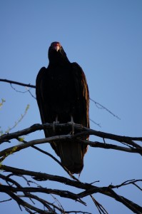
There are a lot of birds around and along with the prolific turkey vultures we saw a gold fronted woodpecker, a yellow chested chat and a vermillion flycatcher ( these were all identified with the help of other campers).

Turkey Vulture

Turkey Vulture

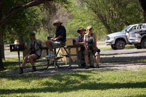
We also saw a clutch of the not so rare Birder Americanus. This species travels in groups and is sometimes mistakenly identified as Hiker Americanus. However the discerning eye will note the subtle differences. Border Americanus is identified by the large optical equipment that is suspended from their necks and the multi pocketed vests across their chests. Hiker Americanus however is distinguished by the oft carried walking staff, short pants, large boots and of course the ubiquitous backpack. One common feature to both species that is the most frequent cause of misidentification is the Tilley Hat which adorns both species heads.

Birder Americanus - in habitat

Birder Americanus – in habitat

We went to the end of the nature trail and could look and hear across the Rio Grande River. The sounds of a horseback rider on the other side of the Rio Grand echoed clearly to our vantage point.

There was a sign as we started the trail that informed us purchase from Mexican Nationals was forbidden. We didn’t understand what that meant until we saw some decorative items for sale along the trail, unattended but with marked prices and bottles for payment. We also saw as we stood at an overlook a Mexican crossing the river, while someone stood watch on the other side, bringing more painted walking sticks to their vending spot.

After returning from our walk we packed up and moved to the Basin Campsite which is nestled in the Chisos Mountains. This site was a totally different landscape. We were surrounded by steep sided mountains under a very strong sun. Sitting in the shade was the only option for the afternoon as it was too hot for any activity. The locals keep telling us that by Big Bend standards this is not hot yet and that within the week temperatures of 100 F would not be abnormal. It appears that April is the peak month at this park due to those excessive temperatures in the summer.

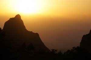
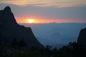
After a relaxing but very hot afternoon we walked up a trail to the park restaurant whose deck provided a panoramic view of a spectacular sunset.

image

We returned to camp in the dark (being very mindful of the warning signs that there had been daily sightings of a mountain lion in the campgrounds) for a late supper of barbecued hamburgers but as the wind had risen to almost gale force it was a challenge to keep items on the table or even to keep the barbecue lit so we eventually resorted to cooking in one of the metal food lockers provided at each site for tenters to keep their food away from the bears in the area. Tight quarters but effective.

Whatever it takes to survive

Whatever it takes to survive

image

A full moon rose over the mountains behind us to signal the end to a great day of sights.

April 25, 2013 (Prepped for Route 66)

Left Nashville and it was chilly at 2C with ground fog but otherwise clear. Within a few hours it had all burned off and the temperature rapidly hit 20C. The drive was fine with great roads and maintaining 70mph was not an issue. We were celebrating our good fortune when we hit a detour that cost us over an hour, damn.

Arrived in Oklahoma around 16:40 and made it to our first try at a KOA campground in Chekotah. It is just off the highway although based on the noise you would swear it was built along the highway median but it is fine for what we wanted… quick highway access, no fuss, wi-fi and most important, laundry. Carla was tired of driving with the windows open, ha ha. All good now and with a just short drive north tomorrow morning we get to jump on one of the best remaining sections of the Mother Road, Route 66. As a Steinbeck fan I am looking forward to the National Museum in Elk City later tomorrow. And some of the original soda fountains and best burgers of the day.. More tomorrow. No pics today unless highway signs through a bug-riddled windshield is your thing.

5 days from tomorrow to make the meet-up and just 950 miles left to go! Lots of time now so we are slowing the pace.

April 24, 2013 – (A l’il bit Country)

While we had good intentions of getting an early start, I’m not sure if it was the peaceful camping site, or the fact we are just now getting into the slower-paced groove, that didn’t get us away until after 9AM, albeit our best intentions. Learning from our mistakes the previous evening, we really didn’t want to hit the tacky “Strip” again, and found a by-pass route out of the national park that skirted the towns and gave us a lovely drive through the hills of SE Tennessee.

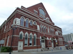
Later, as we scooted down the I-40, on our way to Nashville, we were hit by a downpour of torrential proportions, which slowed us down just a little bit more, but then miracles or miracles, we decided to turn on the radio (Yes, Sean and I have just been enjoying each other’s witty conversation for the past 5 days), and realized we had gained another hour, which brought us in to Nashville at about 12:30PM. A quick clean-up and a check of e-mails and such, and we were off to see the town. First stop – Ryman Auditorium, which first opened as the Union Gospel Tabernacle in the late 1800s and then became the home of the Grand Olde Opry, until 1974, when it moved to a larger facility. Dolly, Hank Williams, Willie Nelson, June &Johnny Cash… the list went on and on, and the costumes on display were amazing. Intricate beading and designs that would have taken weeks. We decided to take the backstage tour which had an interesting guide, with lots of antidotes. For example, did you know that the song “Crazy”, sung by Patsy Cline, was written by Willie Nelson, and she didn’t want to record it, until her manager convinced her to sing it the way she thought it should be sung, not the way Willie sang it…and it became the #2 song of 1962 and is known as her ‘signature’ song!!! Or that Johnny Cash got kicked out as a member of the Opry because he was drunk one night (of many) and smashed all the lights on the stage. He was never invited to be a member again, and only brought back as an invited guest! It was a great tour and combined a little of the Country Music Hall of Fame with the Opry tour, only smaller, which was perfect for us.

Grand Olde Opry

Grand Olde Opry

Leaving the Ryman, we walked the Broadway strip for the rest of the afternoon, pausing for drinks and musical highlights at the “whiskey Bent Saloon” then “Tootsies”, and landed at a bar we can’t remember the name of, but had 3 great musicians, that could play just about anything. One would start to sing or play, theur i-phones would recognize the tune and then quickly provide the lyrics and then all were off and signing the same tune. We relaxed, and laughed, had supper and headed back to the hotel, hoping for an early start the next day. Tech wars will have to wait…

Carla

April 23, 2013 – (Rollin’ rollin’ rollin’, keep them doggies rollin’, rawhide!)

Clear again today at 14C and very nice with light winds. The MRT likes windless days as she gets a bit of a shimmy when heading downhill with side winds and passing the big rigs (something Phil has yet to experience from my side, ha, ha) can be a bit of a ride. Especially with the Virginia/Tennessee speed limits at 70 mph! Whatever happened to the 55 mph fuel-economy speed limit? Doesn’t matter, it cost $135 to fill the MRT in Canada and just $80 here so lead-foot isn’t as big an issue except for David Suzuki perhaps.

Anyhow, I digress, after struggling through Tech Wars day 2, we received advice from the Verizon corporate store that was both timely and relevant. The Verizon device we bought from a Verizon Dealer store (not to be confused with a corporate store), to turn our MRT into a wi-fi hotspot, works incredibly well… as long as you are in any Verizon store. If you leave, it just doesn’t want to work, but just some times, just enough to make you really angry. And of course, the device isn’t solid enough to penetrate any Verizon store front window so we were unable to use the most obvious and satisfying solution. We now have a two month data plan with no way to access it. But the battle ain’t over yet. More coming later in coming days, I am sure…

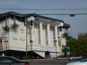
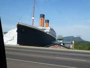
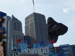
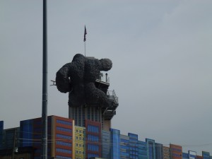
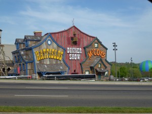
End plan for the day was to reach the Great Smokey Mountain National Park. It straddles Virginia and Tennessee and was apparently not to be missed. And they were right, a very nice place with running rivers, brooks and streams, and trees a plenty. However, to get through to the serenity waiting, we had to pass through a surreal gauntlet of plastic and poor taste called Pigeon Forge. We don’t know of a proper equivalent although Old Orchard Beach in Maine comes within 10% perhaps. Pigeon Forge is a 30 mph zone though a main strip that runs for about 5 miles with every go-cart, dinner theater featuring scrapping hillbillies, KFC, burger joint (multiple), pancake house (multiple), Dollywood, mini-golf & Ferris wheels. Picture a Bill Lynch fair on nuclear steroids. Even boot stores that offered cowboy boots for $400 and included 2 extra pairs ‘free’. Anyhow, one tacky highlight was a ginormous King Kong up a skyscraper mock-up batting away at bi-planes circling his head. And also not to be missed was the upside-down full size mansion and of course, what inland entertainment wouldn’t be complete without the front end of the Titanic complete with the iceberg that sunk her. I have no idea how they managed to recover both the berg (without it melting) and the front end but I suspect from the lineups that they have enough cash to start the hunt for the aft-end now  At least the funnel count will then be correct.

UpsideDownMansion

Titanic

KKFront

KKBack

HatfieldMcCoys

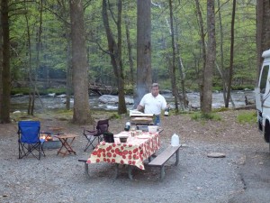
The nice thing about this sort of cultural ‘fence’ is that the folks that favour Pigeon Forge don’t often venture into the wilds beyond and that is where we were headed. Negotiating the gauntlet was worth it. It was a very nice park as you can see below. Steak dinner with potatoes on the grill, a Caprese salad and a 7-year old Nicaraguan rum capped off another fun day.

SeanSmokeyCamp

We have until May 1 to pick up the speed and meet Phil and Di in the BRT and Jane and Ike in the LRT (RT = Rolling Turd for the uninitiated) in Grand Canyon so we will be picking up the pace in days coming…

April 24, 2013 – (Carla & Sean try and remember anything about Country Music)

Ya Vol, Y’all

We felt that a leisurely morning was in order so it was 9:00 before we were untethering the mother ship’s umbilicals from water and electricity. I was heading out on my bike to the registration area to pay for our night’s stay when I noticed that my rear tire was flat. Why is it never the front tire, the easy one to change, that goes flat? I walked up to pay our bill and then came back to tackle the tube change. With some good investigative work on Ike’s part we found that the problem was a thorn that had penetrated through the tire into the tube. It seems in Texas even little thorns have big ambitions.

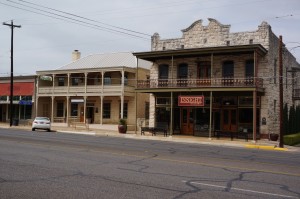
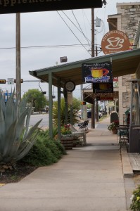
So by the time we had everything sorted, stopped along the way to take a few pictures etc. it was almost noon by the time we rolled into Fredericksburg. Fredericksburg is an interesting town of about 10,000 people that was originally a German settlement. It still maintains a lot of that heritage as demonstrated by its Bavarian styled houses and Germanic street names but there is no doubt that this is still a Texan town, albeit one with a curious cultural mash up. Imagine someone wearing lederhosen with cowboy boots and a ten gallon hat and you will have some sense of the cultural dichotomy that is Fredericksburg.
Beautiful Downtown Fredericksburg

Beautiful Downtown Fredericksburg


Right next door to the cowboy hat and boot store is the decorative German candle store. In my mind some of the ugliest creations in wax since the great fire at Madame Tussaud’s Wax Museum. Four lanes of traffic form the Main Street and inhibit crossing from shops on opposite sides of the thoroughfare except at intersections. In one shop specializing in leather goods there were lovely hand tooled Bible covers right next to the lovely hand tooled hand gun cases, nothing like covering your odds.

We spent a couple of hours walking around and Ike took advantage of the time to get an oil change. A late lunch at a brew pub followed by a coffee stop gave us chance to catch up on e-mails and update the blog. It also provided us with an opportunity to mark the progress of Family # 2 who are burning a swath across ‘merica in the MRT in anticipation of our scheduled May 1 rendezvous at the Grand Canyon.
Coffee and Catchup?

Coffee and Catchup?


As it was now getting late we decided that we would head for the closest state park we cold find and settled on the South Llano River State Park. The drive into the park was scenic but there were ominous reminders that we were in flash flood country, witnessed by flood water level gauges marked in one foot increments to 5 feet above pavement level. I’m pretty sure that even the bulk of the BRT would lift off in those conditions. Fortunately there has been a dry spell here for a while, a church in Fredericksburg prompted its parishioners to ‘pray for rain’. After seeing the markers I hoped that their prayers, if answered that night, would be answered as one and not cumulatively.
On arrival at the park we were advised by the park host that the park was a favourite site for bird watchers and that there were bird blinds scattered throughout the park and that the birds were attracted by regular feelings each morning so we looked forward to seeing even more unique bird life. As we spoke a beautiful red Cardinal landed behind him.

We also noted that deer roam freely throughout the park and although cautious have clearly become habituated to humans. As we had a late lunch, supper was a light meal of pasta and tomato sauce that Jane prepared. The warm breezes of Ink Lake had been replaced by a cold wind so supper was inside, preceded by a planning session. We now have to be very careful with our time as our rendezvous with family # 2 at the Grand Canyon on May 1 is rapidly approaching.